
Most travelers fly into Podgorica and leave within the hour, heading straight for the coast or the mountains. That is a mistake. Montenegro's capital is not a postcard-perfect medieval town, and it does not pretend to be. What it offers is something rarer: a living city with layers of history buried under concrete and glass, a food and wine scene that punches above its weight, and a position at the crossroads of every landscape Montenegro has to offer. If you are wondering about Podgorica things to do, the answer is more than you would expect from a capital that most guidebooks dismiss in a single page.
Podgorica is easy to misread. From a car window it can look like a loose collection of boulevards, apartment blocks and low-rise neighborhoods. On foot, another capital appears: rivers cut through limestone, Ottoman lanes meet postwar civic architecture, and the remains of ancient Duklja sit only a short journey from the center. This is not Montenegro's prettiest postcard. It is the place where the country's history, institutions and everyday life are most legible.
I have spent years exploring this city on foot, by bike, and from the terraces of its riverside cafes. Podgorica rewards the curious traveler — the one willing to look past the socialist-era apartment blocks and discover an Ottoman quarter, a world-class winery fifteen minutes from the center, and a national park that begins where the city bus route ends. For travelers, that difference is the point. Podgorica makes a useful first or final stop, but it deserves more than an airport night. Give it one full day for the historic core and museums; add a second for Duklja, the Cijevna falls or a slow meal outside the central grid. For a broader shortlist of attractions, compare this cultural reading with our Podgorica city guide, then use the itineraries below to decide what is worth your time.

Brief Overview
Podgorica has been Montenegro's capital since 1946, though a settlement has existed here for millennia. The city sits at the confluence of two rivers — the Ribnica and the Moraca — in a broad, sun-baked plain ringed by mountains. It is not merely Montenegro's administrative address. The 2023 census published by MONSTAT counted 179,505 usual residents in the municipality — 28.78% of the national population of 623,633 — at the 31 October 2023 reference moment. Older summaries commonly round the capital to roughly 200,000 residents and about a third of Montenegro's population; either way, this is where the country's administrative, economic and cultural weight sits. That figure refers to the municipality, which is larger than a tightly defined city center, but it explains the capital's gravitational pull. Universities, ministries, courts, hospitals, jobs, daily services and major transport connections are concentrated here. Montenegro's coast can feel seasonal; Podgorica feels inhabited year-round.
| Measure | Verified finding | Traveler implication |
|---|---|---|
| Population | 179,505 usual residents in the municipality in 2023 | Expect a functioning national capital, not a resort town |
| National share | 28.78% of Montenegro's population | Services and transport options are comparatively concentrated |
| Historic record | The name Podgorica appears in a 1326 archival reference | The city's visible layers predate its modern boulevards |
| Archaeology | Duklja is protected cultural property of national significance | Allow extra time and respect access or conservation restrictions |
| Airport transfer | Official bus information is published but explicitly subject to change | Check the operator on the day rather than relying on an old timetable |
The city you see today is largely a product of reconstruction. During World War II, Allied bombing destroyed an estimated seventy percent of Podgorica's buildings. What rose from those ruins was built in the utilitarian Yugoslav style — wide boulevards, concrete apartment blocks, socialist-realist monuments. For decades, that was the face Podgorica showed the world.
Look more closely, though, and you will find Ottoman-era stone bridges standing alongside cable-stayed modern landmarks, fragments of Roman-era Doclea in the northern suburbs, and a massive Orthodox cathedral completed just over a decade ago. The mix of modern, Ottoman, and Yugoslav architecture gives the city a texture unlike anywhere else in the Balkans. Modern reconstruction explains the wide roads and heterogeneous architecture; it should not be dismissed as a failed old town.
Geography is the other thing to understand. From the center, you can reach Skadar Lake in twenty minutes, the Adriatic coast in under an hour, the old royal capital of Cetinje in thirty minutes, and the Moraca Canyon in about the same. Podgorica is not just a destination — it is the best base camp in Montenegro.
History
The capital's past is better read as overlapping nearby settlements and political identities than as one straight line. Archaeological evidence around the Zeta plain is much older than the name Podgorica. Doclea developed north of today's centre in the Roman period, while medieval Ribnica and Podgorica appear later in written history. These places belong to the same wider landscape without forming one continuously preserved street plan.
Ancient and Roman Period
The Podgorica region has been inhabited since the Iron Age, when two Illyrian tribes – the Labeates and the Docleatae – populated the area between the Zeta and Bjelopavlici valleys. The Labeates were known for their military organization, while the Docleatae focused on economic growth and trade, centered around the Zeta River valley [2].
Approximately three kilometers northwest of modern Podgorica lie the ruins of Doclea (later Duklja), a significant Roman-era settlement. Doclea holds a notable claim to history: it was from this town that the mother of Roman Emperor Diocletian (who ruled 284-305 AD) hailed. Romans later “corrected” the name to Dioclea, assuming an “i” had been dropped in vulgar speech. The South Slavic form “Duklja” persisted for centuries [1][3].
At its earliest recorded foundation around 426 AD, the settlement on the site of present-day Podgorica was called Birziminium. Through the medieval period, it became known as Ribnica, after the river that runs through it.
Duklja: the ancient city still being investigated
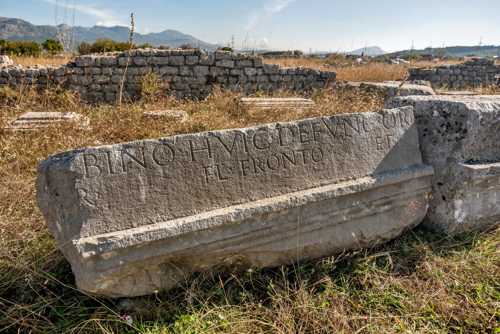
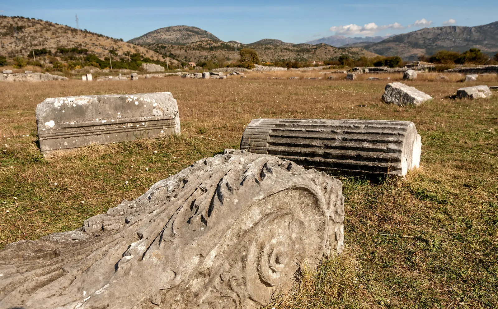
North of central Podgorica, the archaeological site of Duklja preserves the ground plan and material remains of an important Roman-era settlement. It is not a polished open-air museum with a prescribed visitor circuit. Its value lies in the landscape of walls, foundations and continuing inquiry. In June 2026, Montenegro's Administration for the Protection of Cultural Properties reported that systematic archaeological work was continuing at Duklja, including research around a temple complex and conservation planning for a mosaic found in 2019.
That living-research status changes how to visit. Do not climb on masonry or treat fenced areas as obstacles to bypass. The government describes Duklja as cultural property of national significance under a special protection regime. Access may shift during fieldwork or conservation, so verify conditions locally before setting out. The site's exposed terrain also offers little shelter: carry water and avoid the hottest part of a summer day.
Medieval Ribnica and the Name “Podgorica”
The name Podgorica first appeared in historical records in 1326, in a document held in the Kotor archive. During the medieval period, the settlement at the confluence of the Ribnica and Moraca rivers grew as a trading crossroads. Its strategic position between the fertile Zeta Plain and mountain passes made it a natural commercial hub [3][4].

Ottoman Period (1474-1879)
The Ottoman Empire captured Podgorica in 1474, and the city became a kaza (district) of the Sanjak of Scutari. In 1479, the Ottomans built a large fortress at the confluence of the two rivers, and Podgorica became the main Ottoman defensive and offensive bastion in the region [5]. The municipal chronology dates Ottoman rule from 1474 until the city's incorporation into Montenegro after the Congress of Berlin in 1878; the tourism organisation describes Stara Varoš as the Ottoman-period core from 1474 to 1879.
Over four centuries of Ottoman rule, the city developed along the left bank of the Ribnica in a manner typical of Ottoman settlements – narrow winding streets, mosques, a central market, and a distinctive oriental character. The neighborhoods of Stara Varos (Old Town) and Drac remain as surviving examples of Ottoman-era Podgorica, along with the iconic Clock Tower (Sahat Kula), two mosques, and the characteristic street patterns [5][6].
By the end of Ottoman rule, Podgorica housed approximately 1,500 houses with more than 8,000 residents of Orthodox Christian, Roman Catholic, and Muslim faiths living together [1].
Liberation and the Principality of Montenegro
The Montenegrin-Ottoman War ended in 1878, and the Congress of Berlin recognized Podgorica as part of the newly established Principality of Montenegro. This marked the end of four centuries of Ottoman control and the beginning of rapid modernization [4][7].
World War II Destruction
World War II devastated Podgorica. The city was bombed over 80 times throughout the war by various forces; the municipality's own history records more than seventy bombings, followed by extensive postwar reconstruction. On May 5, 1944, the United States Army Air Forces (USAAF) bombed Podgorica in an attack targeting Axis positions, killing approximately 400 civilians in a single day. Over the course of the entire war, a total of 1,691 people were killed in the city [1]. Precise wartime casualty totals remain difficult to corroborate against institutional sources, so treat these published figures as reported rather than settled.
The historical Ottoman and pre-war buildings were almost entirely destroyed, leaving the city in ruins by liberation.
Titograd: The Yugoslav Era (1946-1992)
After World War II, Podgorica was designated the capital of the Socialist Republic of Montenegro within Yugoslavia. In 1946, the city was renamed Titograd in honor of Josip Broz Tito, president of the Socialist Federal Republic of Yugoslavia from 1953 until his death in 1980 [1][8]. The municipal record dates republican-capital status under the name Titograd to 13 July 1946.
The city was rebuilt from scratch in the functionalist socialist style – wide boulevards, concrete apartment blocks, and institutional buildings. Titograd experienced rapid population growth: from 10,238 inhabitants in 1948 to 96,074 by 1981. Schools, factories, scientific and cultural institutions, and health facilities all opened at pace, and the city quickly assumed a leading role in the region [1][8].
The airport’s IATA code, TGD, still reflects the Titograd name to this day [9].
Return to Podgorica and Independence (1992-2006)
As Yugoslavia dissolved, a referendum on April 2, 1992 led to the city reverting to its historic name, Podgorica. In the 2006 Montenegrin independence referendum, citizens voted to separate from the State Union of Serbia and Montenegro. Montenegro declared independence on June 3, 2006, with Podgorica as its capital [1][10].
In 2006, the year of independence, the former Ivan Milutinović Square was reconstructed and renamed Republic Square (Trg Republike); in 2016 the city assembly renamed it Independence Square (Trg nezavisnosti). The city has since seen steady investment and development as the capital of an independent European state pursuing EU membership.
| Date | Event |
|---|---|
| 1st c. AD | Doclea |
| 1326 | name recorded |
| 1474 | Ottoman rule |
| 1878–79 | into Montenegro |
| 1946 | Titograd; capital |
| 1992 | Podgorica again |
Source: podgorica.me, podgorica.travel, muzeji.podgorica.me
Our separate account of Podgorica's turbulent history provides a longer chronological frame; here, the important travel insight is that the city's discontinuities are meaningful. The twentieth century explains much of the city's appearance: monumental public buildings, generous boulevards and residential blocks are not an interruption in the story; they are primary evidence of it.
Old Town and Turkish Quarter
The neighborhood known as Stara Varos — literally "Old Town" — is the most atmospheric quarter in Podgorica, the one place where the city's pre-war character survives intact. This was the Ottoman Turkish quarter, and wandering its narrow lanes feels like stepping into a small Balkan town that time forgot. Around the Clock Tower, the urban grain is smaller: short lanes, courtyard walls, houses and religious buildings rather than the broad axes found across the river.
This is a neighborhood, not a preserved stage set. Its fabric has been altered repeatedly by war, rebuilding and ordinary development, and the pleasure lies in noticing fragments rather than expecting an intact old city comparable with Kotor. Start here before the streets warm.
Sahat Kula (Clock Tower)
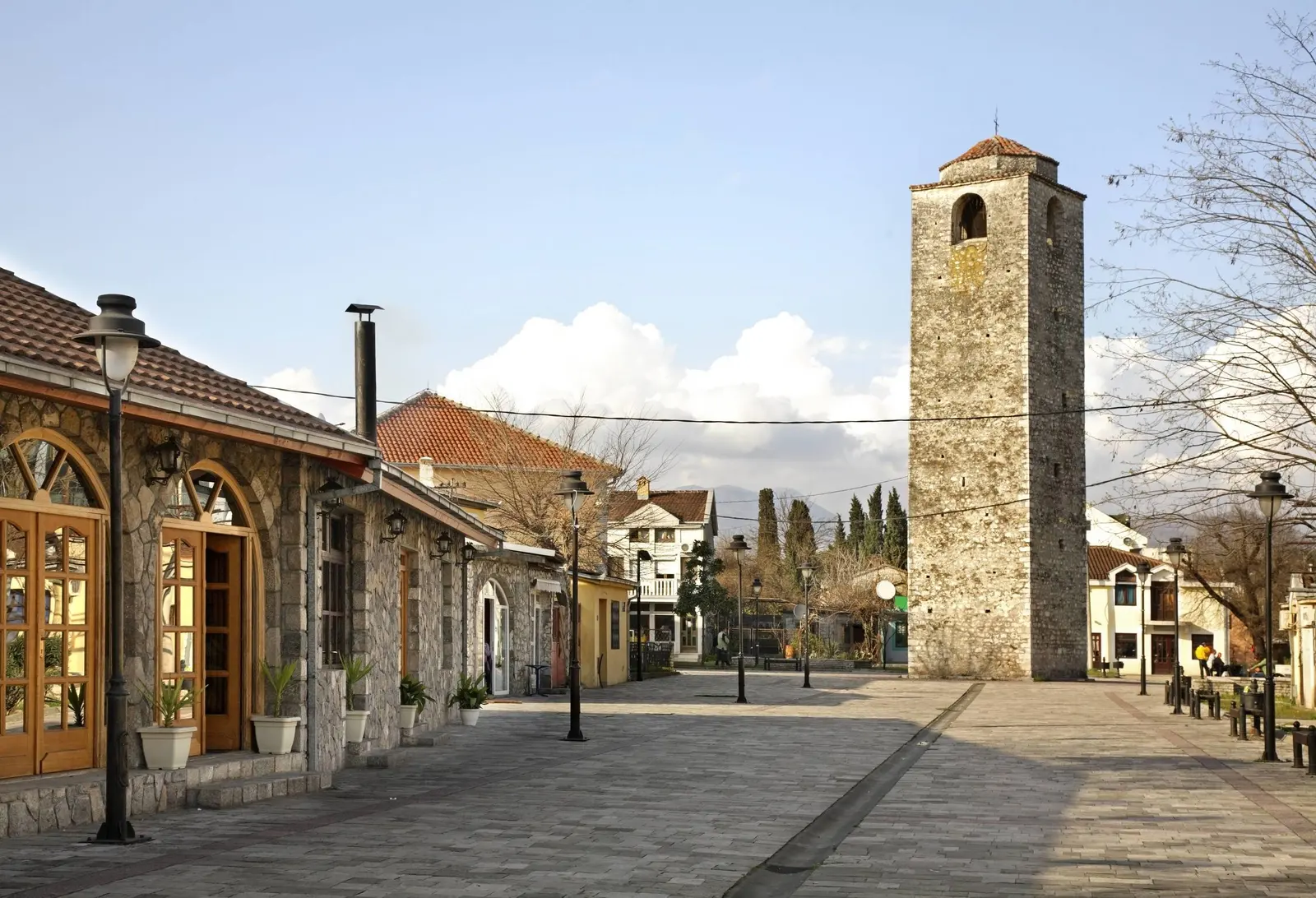
The most prominent landmark in Stara Varos is the Sahat Kula, an Ottoman clock tower dating to the seventeenth century — the official tourism organisation dates it to the 18th century. Standing about sixteen meters tall, it was once used to call the faithful to prayer. The tower has survived earthquakes, wars, and the total rebuilding of the city around it. You cannot enter, but it remains the quarter's clearest vertical marker and an excellent reference point for navigating the old quarter.
The Old Turkish Bridge and Sastavci
Spanning the Ribnica River at the edge of Stara Varos, this small Ottoman stone bridge has a quiet charm, especially in early morning when the light hits the water and there are no crowds. It connects the old quarter to the newer parts of the city.
The small single-arch bridge at Sastavci, where the Ribnica meets the Morača, is another useful hinge between eras. Some visitor literature assigns it an ancient or Roman origin, but its dating is debated — even the official tourism page uses “believed” language. Treat it as a handsome historic river crossing with uncertain dating, not proven Roman infrastructure. The defensible claim is simpler: it is one of the most atmospheric places to observe how water and settlement meet. River levels and surfaces vary; steep, polished or unguarded edges deserve care.
Mosques and Narrow Lanes
Two historic mosques anchor the quarter: the Osmanagic Mosque and the Starodoganjska Mosque. Both are active places of worship — sacred sites, not exhibits. If entry is permitted, follow posted rules and avoid interrupting prayer. The surrounding streets are lined with low stone houses, some renovated, some crumbling gently. Traditional cafes serve Turkish coffee to old men playing cards. Give yourself at least an hour to wander without a fixed route — that is the best way to experience Stara Varos.

Modern City Landmarks
If the Old Town represents Podgorica's Ottoman past, the modern center represents its European ambitions. Since independence in 2006, several new landmarks have become symbols of the new Montenegro. Walk through the central grid rather than judging it only from a taxi.
Millennium Bridge
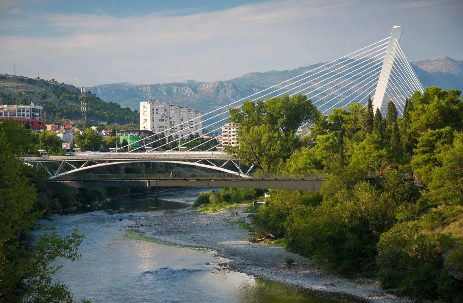
Completed in 2005, the Millennium Bridge is arguably the most recognizable structure in Podgorica. This cable-stayed bridge spans the Moraca with a single pylon and a web of cables that give it a harp-like silhouette. Lit up in various colors at night, it has become the unofficial city logo. Walk across at dusk for the best views — the river below, mountains in the distance, city lights coming on. Continue toward the river from the centre for the contrast between the older stone bridges and this one.
Independence Square (Trg nezavisnosti)
Independence Square (Trg nezavisnosti), called Republic Square (Trg Republike) until the city renamed it, is the main public square and the centre of civic life, ringed by cafes. Together with Bokeška, Njegoševa and Hercegovačka streets it forms the most convenient pedestrian core: a useful pause for coffee or lunch rather than a checklist stop, and a good starting point for a walk around modern Podgorica.


.jpg&w=2048&q=75)

